Design Overview
The Concept
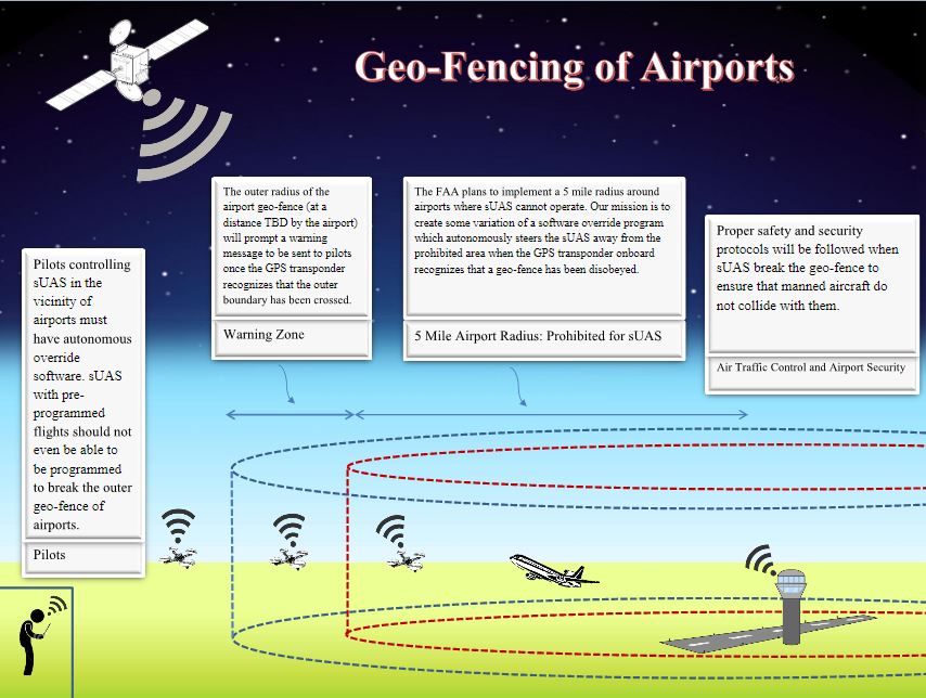
ASPECTS is a universal geofencing solution which may be incorporated on future drone models or retrofitted on previous designs. If a drone user flies their aircraft within approximately 1000 feet of a No-Fly zone, ASPECTS will send the user an initial warning message allowing time for the flightpath to be manually redirected. If the user does not take corrective action before the drone reaches the critical zone, the on-board controller will assume an auto-pilot mode and prevent the drone from entering the perimeter by hovering, landing, or returning to the launch point. This effectively creates a physical barrier around the perimeter of the airport (or other sensitive area), and averts a potentially dangerous situation.
The Implementation
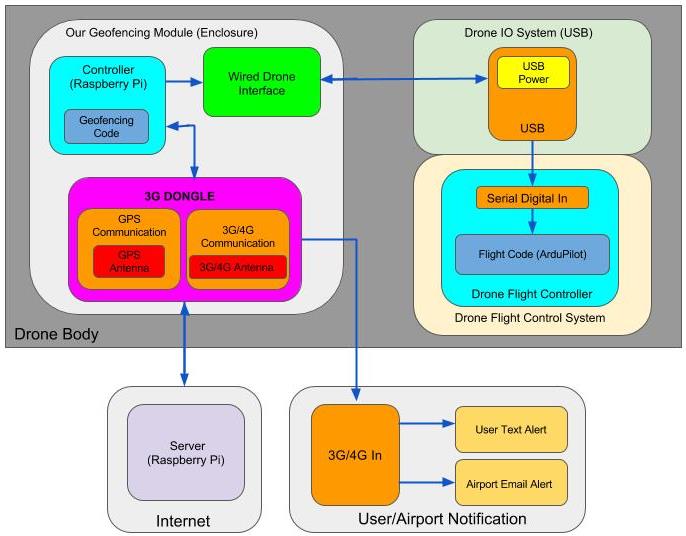
The on-board unit consists of a Raspberry Pi computer, GPS chip, and 3G communication module. It will interface with the existing flight controller to execute commands. By monitoring the location of the drone via satellite, ASPECTS will determine its proximity to local No-Fly zones through a software algorithm on the Raspberry Pi.